The following electronic version is for informational purposes only.
The printed version remains the official version.
Certified correct as passed Third Reading on the 2nd day of June, 2011
Ian D. Izard, Q.C., Law Clerk
APPENDIX B
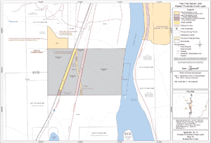
YALE FIRST NATION LAND
APPENDIX B-1
MAP OF YALE FIRST NATION LAND
Appendix: B-1 Yale First Nation Land Overview
APPENDIX B-2
YALE FIRST NATION LAND – FORMER INDIAN RESERVES
Part 1: Land Descriptions of Yale First Nation Land Former Indian Reserves
Note: the Parties will update the Appendices before the Effective Date
| Indian Reserve Name |
Indian Reserve No. |
Land Description1 |
| Yale Town | 1 | BC152, except RR2007 and RD3899 (See Boundary Survey shown on Plan 64580) |
| Four and One Half Mile | 2 | BC152, except RR2007 and 50084 |
| se Qualark | 4 | BC152, except RR1087A (See Boundary Survey shown on Plan 66215) |
| Albert Flat | 5 | BC152, except RR2007, RD3808, 4680 (See Boundary Survey shown on Plan 64716) |
| Squeah | 6 | BC152, except RR1088A (See Boundary Survey shown on Plan 66215) |
| Kaykaip | 7 | thiBC152, except RR1089A (See Boundary Survey shown on Plan 66215) |
| Stullawheets | 8 | BC152, except RR2007, the old and new road on RD3809, the new road on 52414 |
| Lukseetsissum | 9 | BC152, except 837B, RR837C, RR837D, RR2007, 50731 and 57762 |
| Yale | 18 | BC1196 |
| Yale | 19 | BC1197 |
| Yale | 20 | BC1197, except RR2492 |
| Yale | 21 | BC1198, except 4712 |
| Yale | 22 | BC1198 |
| Yale | 23 | BC1199 |
| Yale | 24 | BC1199, except 51125 |
| Yale | 25 | BC1199 |
| 1 Canada Land Survey Records on deposit in Ottawa | ||
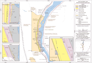
Part 2: Maps of Yale First Nation Land Former Indian Reserves
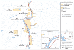
Appendix B-2, Part 2
Yale First Nation Land
Former Indian Reserves
Overview
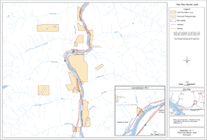
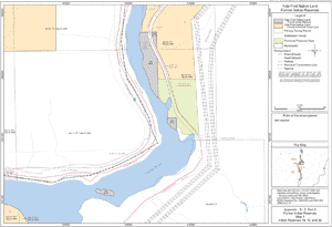
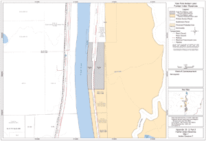
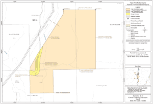
Appendix: B-2, Part 2 Former Indian Reserves
Map 1
Indian Reserves 2, 23, 24 and 25
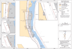
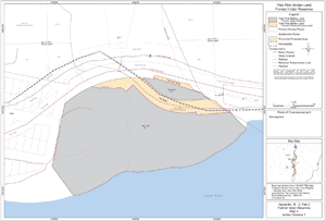
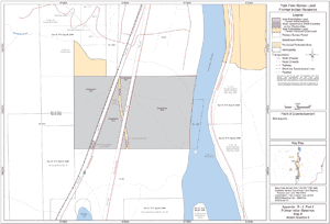
Appendix: B-2, Part 2 Former Indian Reserves
Map 2
Indian Reserves 21 and 22
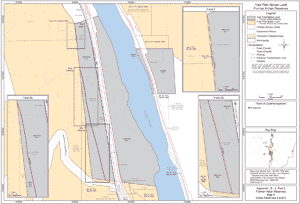
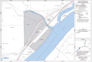
Appendix: B-2, Part 2
Former Indian Reserves
Map 3
Indian Reserves 18, 19 and 20
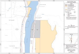
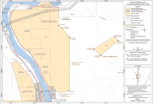
Appendix: B-2, Part 2
Former Indian Reserves
Map 4
Indian Reserve 1
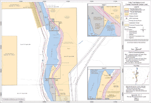
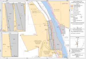
Appendix: B-2, Part 2
Former Indian Reserves
Map 5
Indian Reserves 4 and 5
Appendix: B-2, Part 2
Former Indian Reserves
Map 6
Indian Reserve 6
Appendix: B-2, Part 2
Former Indian Reserves
Map 7
Indian Reserve 7
Appendix: B-2, Part 2
Former Indian Reserves
Map 8
Indian Reserve 8
Appendix: B-2, Part 2
Former Indian Reserves
Map 9
Indian Reserve 9
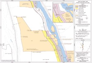
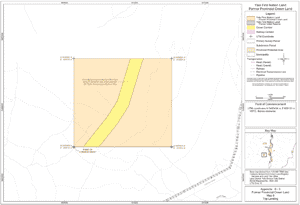
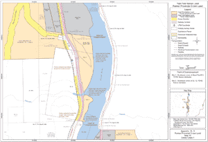
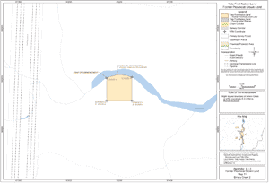
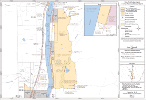
APPENDIX B-3
MAPS OF YALE FIRST NATION LAND – FORMER PROVINCIAL CROWN LAND
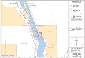
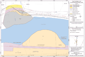
Appendix: B-3
Yale First Nation Land
Former Provincial Crown Land
Overview
Appendix: B-3
Former Provincial Crown Land
Map 1
Sawmill Creek / Sawmill Island
Appendix: B-3
Former Provincial Crown Land
Map 2
Dom's Place / Steamboat Island / Saddle Rock Island
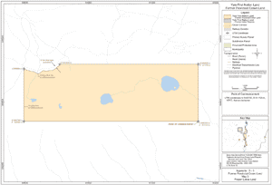
Appendix: B-3
Former Provincial Crown Land
Map 3
Frozen Lakes Land
Appendix: B-3
Former Provincial Crown Land
Map 4
Siwash
Appendix: B-3
Former Provincial Crown Land
Map 5
Mary Ann Creek / Saddle
Appendix: B-3
Former Provincial Crown Land
Map 6
Rock Wall / Toll Road / Old Yale Road
Appendix: B-3
Former Provincial Crown Land
Map 7
Qualark / Sacred Rock
Appendix: B-3
Former Provincial Crown Land
Map 8
Albert Flat
Appendix: B-3
Former Provincial Crown Land
Map 9
Top Landing
Appendix: B-3
Former Provincial Crown Land
Map 10
Emory Creek 1
Appendix: B-3
Former Provincial Crown Land
Map 11
Emory Creek 2
Appendix: B-3
Former Provincial Crown Land
Map 12
Squeah
Appendix: B-3
Former Provincial Crown Land
Map 13
Stulkawhits Creek